STAY CONNECTED: Have the stories that matter most delivered every night to your email inbox. Subscribe to our daily local news wrap.
The Wapiti River breached its banks Thursday afternoon, as seen here by near the off-ramp of Highway 40, adjacent to O'Brien Provincial Park (Photo: Shaun Penner)
High waters

Heavy rains bring flood watches, warnings across Peace Region

Jul 3, 2020 | 11:09 AM

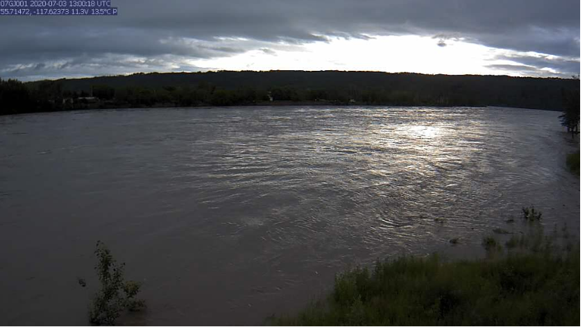
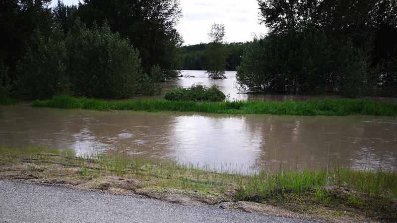
Heavy rainfall across the Peace Country this week has caused many area rivers to breach their banks, and Alberta Environment and Parks (AEP) has issued several flood warnings and watches as a result.

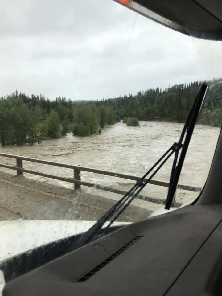
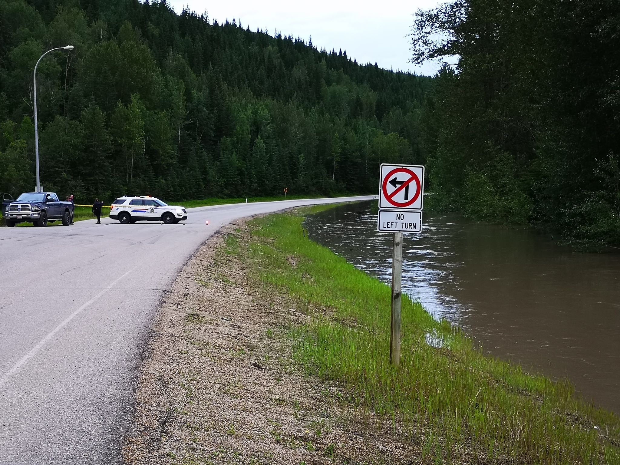
In the Grande Prairie area, a flood watch remains in place for the Wapiti River and its tributaries. AEP says water levels have risen 3-4 metres since rainfall began Tuesday evening. This has caused flooding in the low-lying area of O’Brien Provincial Park along Highway 666, just south of the City. The road between Highway 40 and Nitehawk was closed Thursday evening as flood waters crossed the Highway, but the road has since been reopened.

Highway 666 between Highway 40 and Nitehawk was closed Thursday night due to flooding from the Wapiti River (Photo: Shaun Penner)

Some flooding was also reported near Magoo’s Landing, just east of O’Brien Provincial Park along the Wapiti River, due to the high water levels.

Meantime, a flood warning is in place for the Smoky River near the Hamlet of Watino, east of Rycroft. An evacuation alert has been issued as a result by the Central Peace Regional Emergency Management Agency, as they say the eastern third of the hamlet could be impacted by rising water levels, as well as the Highway 49 bridge and agricultural land.

“Water level rises of approximately 6 m are possible at the Hamlet of Watino, and may reach levels similar or slightly higher than levels seen in 1990 and 1972.”

Water in the Smoky River is expected to peak by Friday night or Saturday morning.

The Smoky River at Watino, as captured at 7 a.m. Friday, July 3 (Photo: Water Survey of Canada / Alberta Environment and Parks)

Also, one of the Smoky River’s tributaries, the Simonette River, has seen its water level rise by 2.5 m. AEP says water levels reached similar levels to those of 2017, when the Simonette River Campground was reportedly impacted.

High Streamflow advisories have also been issued for many other area rivers, including the:

  • Smoky River
  • Little Smoky River
  • Kakwa River
  • Cutbank River
  • Tributraies of the Wapiti River
  • Peace River from the Dunvegan bridge, north to Fort Vermilion
    The water levels of the Cutbank River had risen quite a bit by Thursday morning, seen here from the Highway 40 bridge (Photo: Dean Beardmore)

Areas in the County of Grande Prairie also reported flooding from area waterways on Thursday, including at the Pipestone Creek campground

The County says the campground is open, but with restricted access to the river and Group 2 sites