STAY CONNECTED: Have the stories that matter most delivered every night to your email inbox. Subscribe to our daily local news wrap.
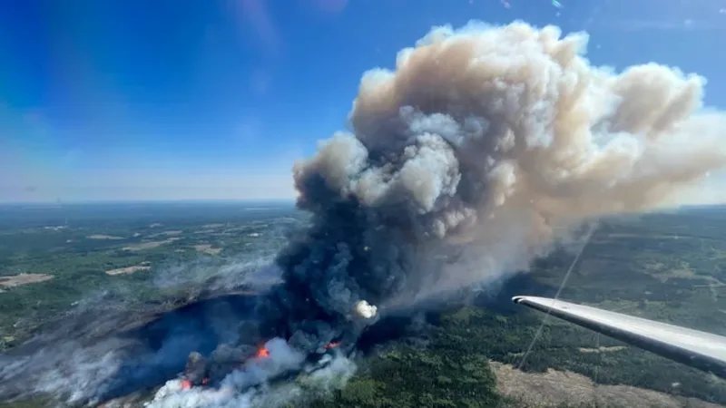
Photo supplied by the Grande Prairie Forest Area Wildfire Information office.
Wildfires

Old and new wildfires listed as out of control

Jun 8, 2023 | 5:10 PM

The wildfire hazard is rated very high in the Grande Prairie, Peace River, High Level, and Whitecourt Forest Areas.

There are places where the hazard is extreme.

The hazard rating is high in the Slave Lake Forest Area.

The Grande Prairie area currently has seven active wildfires, three of which are out of control.

The newest of these fires is located 60 kilometres southwest of Grovedale and has burned 40 hectares.

The two fires in the Boones Lake Complex north of Valhalla have burned a combined 4,800 hectares.

Fire officials are also working with BC Forestry and the County of Grande Prairie on the Peavine Creek and West Kiskatinaw River fires that are burning mostly in the BC Peace, although the Peavine Creek fire has crossed the Alberta border.

The Sturgeon Lake Complex fires are listed as under control at just over 28,800 hectares while the Bald Mountain fire is being held at 19,435 hectares.

The Peace River Banks/Cleardale fire is still considered out of control at 48,500 hectares. The Peace River Forest Area also says the Kimiwan Complex near the boundary of the Peavine Metis Settlement is still out of control at just under 127,000 hectares.

There is another out-of-control fire burning 80 kilometres southwest of High Level. It has consumed 3,079 hectares.

The fire in Fox Lake is still considered out of control at over 93,000 hectares while the fire in the Rainbow Lake area is also out of control at 152,599 hectares.

The three fires in the Eagle Complex near Fox Creek are all still listed as out of control and have burned over 199,000 hectares combined.

In the Slave Lake Forest Area, a new out-of-control wildfire located 18.5 kilometres southeast of Sweathouse has burned 70 hectares.

The Nipisi Complex near the border for Whitefish Lake First Nation is being held at 43,981 hectares.

Tumbler Ridge, (B.C.), the District of Tumbler Ridge and east including Bearhole Lake, is now under an evacuation order due to the West Kiskatinaw River wildfire, which is estimated to be 9,600 hectares in size.

Evacuees from the area must use Highway 29, as Highway 52 is closed, and head to Dawson Creek where you can register at the Ovintiv Events Centre.